Physical features along the river
Drainage Basin :


The Mississippi and its tributaries drain almost all the plains between the Appalachian Mountains and the Rocky Mountains. The Mississippi River has the third largest drainage basin in the world, exceeded in size only by the watersheds of the Amazon and Congo Rivers.
It drains 41 percent of the 48 contiguous states of the United States. The basin covers more than 1,245,000 square miles, includes all or parts of 31 states and two Canadian provinces, and roughly resembles a funnel which has its spout at the Gulf of Mexico. Its discharge, which averages 16,800 cu m per second (593,000 cu ft per second), is the sixth largest in the world.
Waters from as far east as New York and as far west as Montana contribute to flows in the lower river. This area encompasses the nation's most productive agricultural and industrial regions. The drainage basin empties into the Gulf of Mexico.
The Mississippi River Drainage Basin, with MR&T Project area (in pink)

Picture of the drainage basin


Main Stem Levees :
The Mississippi River levees are designed to protect the alluvial valley against the project flood by confining flow to the leveed channel, except where it enters the natural blackwater areas or is diverted purposely into the floodway areas.
The main stem levee system, comprised of levees, floodwalls, and various control structures, is 2,203 miles long. Some 1,607 miles lie along the Mississippi River itself and 596 miles lie along the south banks of the Arkansas and Red rivers and in the Atchafalaya Basin.
The levees are constructed by the federal government and are maintained by local interests, except for government assistance as necessary during major floods. Periodic inspections of maintenance are made by personnel from the U.S. Army Corps of Engineers and from local levee and drainage districts as it is essential that the levees be maintained in good condition for their proper functioning in the flood control plan.
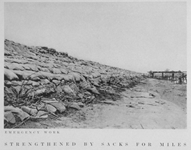
Old levees of Mississippi river


Delta :
The radar image below is the Mississippi Delta taken from the Space Shuttle Endeavor on Oct. 2, 1994 shows an area of 63 by 43 km. where the Mississippi (largest river in North America) flows south and enters the Gulf of Mexico. North is toward the upper right of the view, whose center is at 29.3 North Latitude, and 89.28 West Longitude.
As the river meets the Gulf of Mexico, it loses velocity and dumps its sediment in an expanding fan-shaped, or roughly triangular-shaped zone called a delta (named for the Greek letter shaped like a triangle). The specific form at the outer mouth of the Mississippi where its distributaries spread out and sediments expand into the sea is also sometimes known as a "bird's foot delta." The river's currents are notably strong to create this deltaic configuration. The accumulation of sediment is ever-changing, and the Mississippi's primary channel shifts frequently around in the delta.
The current main shipping channel is the vertical stripe at left center, which contains numerous ships visible as white spots. The surrounding areas consist of coastal mudflats, marshes, and tidal pools.
The radar photo


A brief description of the delta

A photo of the mississippi river delta


Three decades of change in Mississippi river delta

Waterfalls :
The East Mississppi river has a few waterfalls. The following are two examples.
Crabtree Falls is located in the George Washington National Forest in Nelson County, Virginia and is the tallest waterfall in the United States east of the Mississippi River.
The name of the waterfall is thought to have come from William Crabtree, who settled in this part of Virginia in 1777. The waterfall is often credited with being 1,200 feet high (356 meters), but is likely closer to 1,000 feet (305 meters). The cascade with a 400 foot drop also gives Crabtree Falls the title of tallest vertical drop in a waterfall east of the Mississippi River.
The Crabtree waterfall

Glassmine Falls is an ephemeral waterfall in Buncombe County, North Carolina, on Glassmine Branch, near Dillingham, North Carolina.
When it flows, the falls slides down the rock face of Blackstop Knob Mountain down to the North Fork Swannanoa River. The flow is not constant and can sometimes nearly dry up completely. It is most visible after heavy rains, which can be at any time during the year.
A sign at the overlook for the falls claims that the falls is over 800 ft (247m) high. At this height, Glassmine Falls is one of the tallest waterfalls east of the Mississippi River. It also have coordinates of 35°43′45″N 82°19′48″W / 35.729141, -82.329951.
The Glassmine Falls

posted by Loon Ngai Fong at
11:12 PM
![]()

0 Comments:
Post a Comment
Subscribe to Post Comments [Atom]
<< Home